Avoca Reach 7
Priority asset to be protected
Avoca River Reach 7 (Avoca to Archdale Junction) is a priority river reach for protection and enhancement due to its in stream habitat and relatively intact riparian zone. The Avoca River also connects to the nationally and internationally significant Avoca Marshes and Kerang Lakes. Reach 7 currently experiences high rates of erosion and sediment movement, and a large portion is not fenced to control stock access; exacerbating bank erosion and degrading riparian vegetation.
Action on the Ground
New cropping trials aim to reduce agricultural greenhouse gas emissions
The North Central Catchment Management Authority (CMA), in partnership with the Department of Environment, Land, Water and Planning, Glenelg Hopkins CMA and Wimmera CMA, is trialling ways to reduce agricultural greenhouse gas emissions by improving crop nitrogen utilisation.
The project is focusing on measuring and demonstrating on-farm practices and technologies that improve crop utilisation of nitrogen derived from both soil and fertiliser sources.
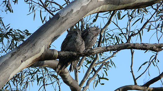
Avoca Avon-Richardson River
The Avoca Avon-Richardson Program area occupies a large part of the region's two western catchments. The total area of the Avoca Avon-Richardson region is just over one million ha (40% of the region's total area). Major towns include St Arnaud, Avoca, Donald, Charlton and Quambatook. The area includes high value Ramsar listed wetlands, state and nationally listed species and vegetation communities (Buloke Grassy Woodlands) and priority river reaches (including Reach 7 of the Avoca River).
Salinity across the catchment
Salinity in the North Central Catchment Management Authority's region
Dryland salinity has long been recognised as one of the main threats to natural resources condition, water quality and agricultural production in the North Central region of Victoria.
Farming for Australian Conditions
Overview:
The Regional Sustainable Agriculture project has been developed to address land-use issues associated with climate variability in the Loddon Campaspe Irrigation Region. The primary focus of the project is to provide information on the productive farming options that use less or no irrigation water, whilst also increasing soil carbon and reducing erosion. Funded through the Australian Government's Caring for our Country initiative, the project will continue until June 2015.
Saltwatch Week
Each year the Waterwatch Victoria hosts Saltwatch Week. Community and schools from all over Victoria can learn about the effects of salinity on waterways in their local catchment by collecting local water samples and testing with a salinity metre to determine salt content.
Echuca Fishway
Kerang PIT Reader Fishway
Fish Monitoring
The Kerang Weir fishway includes a fish monitoring program, implemented by the North Central CMA. Monitoring fish is vital to understand the effectiveness of the Kerang Weir fishway and for improving local native fish stocks.
Box gum grassy woodlands
This project aims to empower landholders within the project area to protect and enhance Box-Gum Grassy Woodland remnants on private land.
Priority asset to be protected: Box-Gum and Grey Box Grassy woodlands.
Northern Eco Connections
Northern Eco Connections
The Northern Eco-Connections project (2014-2019) supports landholders to improve and protect native vegetation on private land, focusing on improving connections and linkages across the diverse landscapes of northern Victoria.
Frogs
Our region is packed with an abundance of diverse natural attractions, from forested national parks to waterfalls, gorges, slow meandering waterways and wetlands of international significance. Our backyard is home to a teeming assortment of flora and fauna, some of which are found no where else.
Campaspe Grassy Woodlands
Proponent: North Central CMA and North East CMA
Priority asset to be protected: Nationally endangered Box-Gum and Grey-Box Grassy Woodlands.
Fish
When using dip nets to sample macroinvertebrates a fish or two are often discovered in the sample.
Enhancing upper catchment waterways
The upper Loddon and upper Campaspe catchments are recognised as containing some of the healthiest rivers and creeks in the north central Victoria region. The catchments support intact and native riparian vegetation, deliver good quality water to downstream users, provide important habitat for aquatic and terrestrial species and are the focus of community interest in river management. The proliferation of high threat weeds, such as blackberry, gorse and willows, along with the impact livestock can have in agricultural areas, threaten the health of these precious waterways.
Platypus and Water Rats
Platypus and Water Rats are two of the more iconic native species that live in our local waterways.
Flood Recovery
The North Central CMA is currently implementing a significant program of onground works and investigations to assist the community to recover and protect our environmental assets following the most significant flooding in January 2011 this region has experienced for over a century.
Funding from both the Victorian and Australian governments will lead to the North Central CMA directly dealing with over 500 landholders and many township communities throughout the region in 2012 and 2013.
Goldfields threatened species
Proponent: Department of Environment, Land, Water and Planning
Priority asset to be protected: A range of Goldfields Bioregion threatened flora and fauna species
Kerang Wetlands protection
The Kerang Wetlands are a unique system of more than 100 wetlands with 23 lakes and swamps recognised under the Ramsar Convention for providing habitat to significant waterbird populations.
Protecting the wetlands includes targeting threatening pests including Weeds of National Significance, rabbits and foxes which all undermine the ecological character of Ramsar sites.
Upcoming Events
There's a lot going on in the Waterwatch space. Here's a snapshot to help you keep up with it all.
Loddon Stressed River
Priority asset to be protected:
The Loddon River downstream of Cairn Curran Reservoir is listed as a flow-stressed river in the 2002 Victorian River Health Strategy.
Overview:
Protecting and Enhancing Priority Wetlands
The 'Protecting and Enhancing Priority Wetlands of the North Central CMA Region' project focuses on maintaining and improving the ecological condition of a number of priority wetlands within the region.
Kyneton Woodlands
Grassy woodlands were once widespread through the Edgecombe, Greenhill, Langley, Pastoria, Pipers Creek and Sidonia districts north of Kyneton. However, they are now considered at high risk of extinction as remnants are reduced to isolated, small patches in decline.
Stock Containment Areas
Expressions of Interest for Stock Containment Area grants have now closed.
For more information, call 03 5448 7124 or freecall 1800 751 751.
Drought Employment Program
Applications for Round Two of the Drought Employment Program across the North Central Catchment Management Authority have now closed.
Kooyoora Connections
The Kooyoora Connections project is supporting local landowners and community groups to improve the condition and increase the area of native vegetation on private land between Kooyoora State Park, Wychitella Nature Conservation Reserve and Mount Korong Nature Conservation Reserve.
Remnant Grassy Ecosystems
The Remnant Grassy Ecosystems project aims to support landowners to protect native vegetation and improve habitat condition on their property.